Place Making Maps
Capture what matters most
Custom illustrated maps made with a designer’s eye and a landscape architect’s understanding of place.
I create custom hand drawn maps for landscape architects, urban designers and place makers.
Many designers can make a map look beautiful, I can also make maps that are accurate, professionally considered and true to how a place feels. This is because I have trained and worked in both Landscape Architecture and Graphic Design. Having this combination of experience and understanding is unusual and means I bring something different to every map I make.
Place Making Maps
Clarity, character and impact
For professional place makers, such as Landscape Architects and Urban Designers, hand-drawn maps are appealing, specific and characterful. Detailed, hand-drawn, illustrated maps can communicate important, technical information clearly and creatively, making complex ideas easy to understand.
I understand the nuance and needs of a custom site plan or map and will work closely with you to create a map that draws viewers in and engages people in an idea as well as leaving a favourable and memorable lasting impression.
A hand-drawn map can still include all the necessary technical elements but is softer and freer by design becoming a more emotional piece of work created that can be easily understood by a wide audience.
A hand-drawn map can help to promote an idea to a client, community or stakeholder and highlight key elements of a project whilst setting the work in the wider landscape context.
Map visuals can further be used across reports, consultations and project promotion to create a cohesive and clear message from the design team.
Custom maps and site plans:
Enhance a project’s visual appeal
Make sites and ideas easier to understand
Communicate directly to general public
Build a story behind the design
Stand out from competitors
Greening the Grosvenor Estate
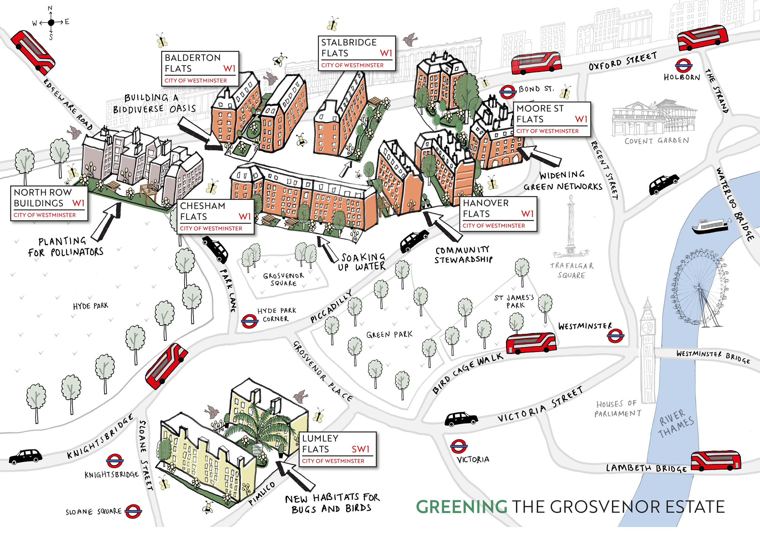
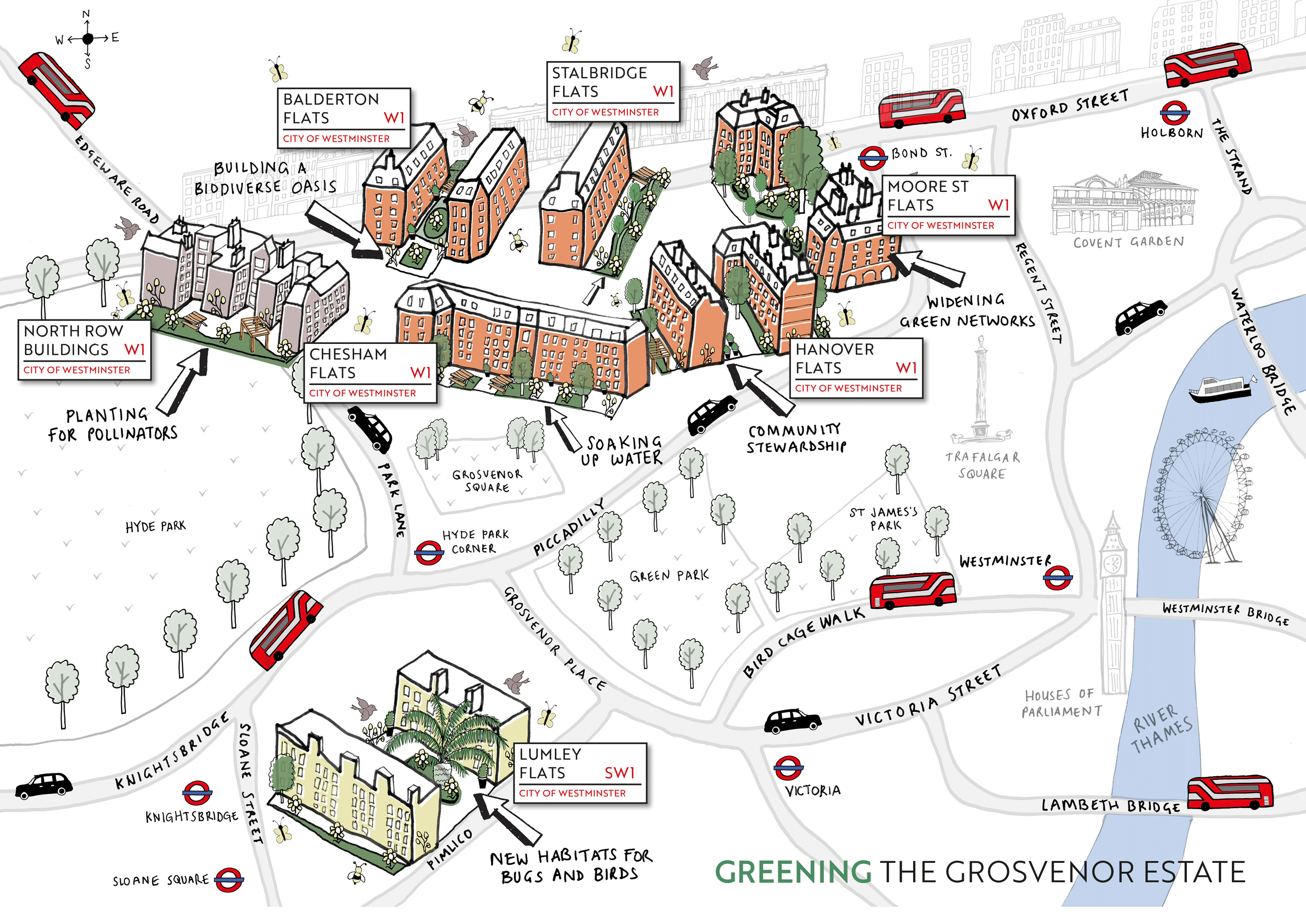
The above map was commissioned by the London based Landscape Architecture firm Turkington Martin. The brief was to create a highly-detailed drawing of 6 project sites across London. The map needed to encourage people to delve into it and spend time absorbing all the information across the map.
Selected Case Studies
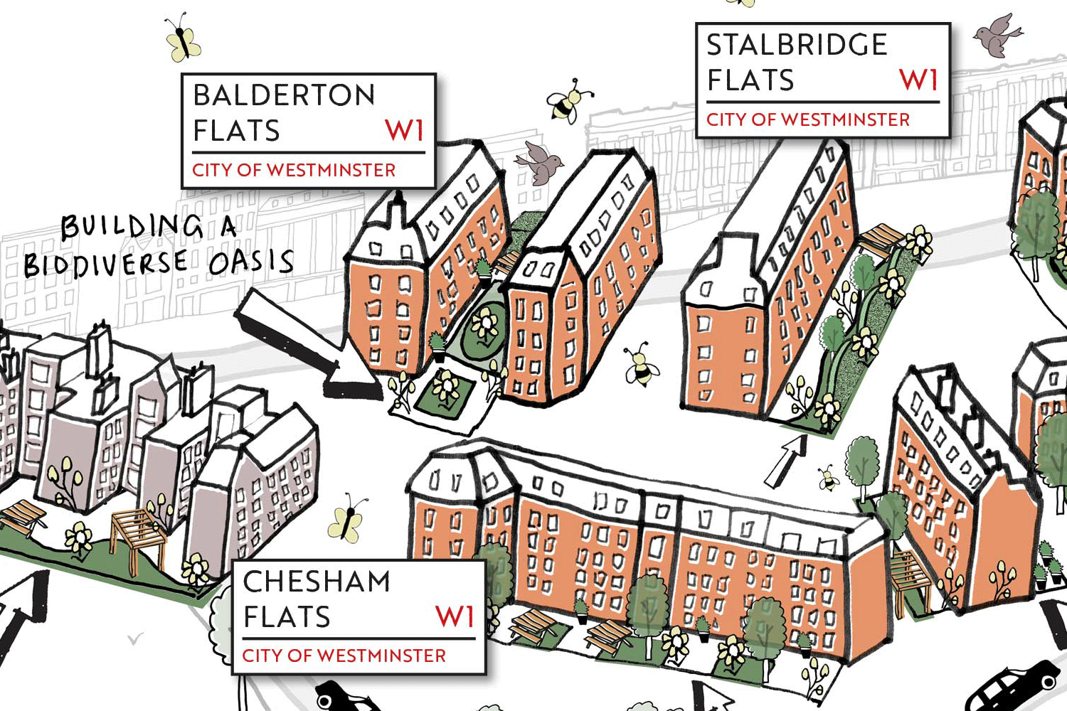
Project map detailing biodiversity measures being implemented across a range of sites in central London.
URBAN DESIGN MAP COMMISSION
Place Making Map
Brief: Create a hand-drawn illustrated map that sparks conversation and draws viewers in.
Turkington Martin, a firm of Landscape Architects based in London commissioned me to create a hand-drawn map depicting the work they were doing to ‘green’ residential properties within The Grosvenor Estate.
The map needed to locate the buildings in central London, depict the biodiversity work happening in each of the blocks and crucially attract attention to the project.
I spent time drawing and redrawing the base map so that the sites were the focus of the illustration whilst sitting comfortably in the wider London surrounding. Once the base map was resolved, I experimented with various ways of depicting the buildings so that the biodiversity work could be communicated logically and clearly.
Finally, I added in colour and peripheral detail such as London buses and London landmarks.
Commissioned by Turkington Martin, London
Have a place that needs mapping?
Tell me about your project and I'll come back to you within two working days with a personalised quote.